


blah blah blah
Mt. Wolf
Length: 10.5 miles out-and-backDifficulty (click for info): Very Hard
Elevation Gain: 2450 feet (+1160 feet on return)
Rating (click for info): 7/10
Elevation: 3500' (Wolf), 3009' (Blue Ridge), and 2760' (Dilly)
Prominence: 920' (Wolf), 189' (Blue Ridge), and 220' (Dilly)
Driving Directions:
Trailhead and parking area are on Rt. 112 in Woodstock, NH, 3.5 miles northwest of Rt. 118 and 4.8 miles southeast of the eastern junction with Rt. 116. Park in the large lot for the Appalachian Trail crossing (Beaver Brook Trail) on the south side of the road, just south of Beaver Pond Scenic Area and just west of the Lost River visitor center and the height of land in Kinsman Notch. Click here for a Google map.
About the Hike:
A rather isolated mountain by trail, Mt. Wolf is seldom visited by White Mountain day-hikers. It sees plenty of traffic as a stop on the Appalachian Trail, but most hikers fail to find much of interest on Mt. Wolf. Indeed, the summit vista which was once revered as one of the famed "52 With-a-View" has become overgrown with trees, and reaching it involves a 5-mile trek over the southern portion of the Kinsman Ridge, well-known by White Mountain hikers for its rugged character. Mt. Wolf may be an example of a hike in which the journey is more worthwhile than the destination. The trek to its summit from Kinsman Notch involves some varied scenery, including the great view from the Dilly Cliffs, beautiful fern glades and other lush forest scenery, and the peaceful shores of Gordon Pond. Though not for everyone, the hike to Mt. Wolf may be of interest to hikers who are looking for a different kind of scenery in a less-visited corner of the Whites. As you drive through Kinsman Notch, one of the major mountain passes of the White Mountains, you will notice the tortured slopes of the low yet looming Dilly Cliffs forming the north wall of the notch. This is the first stop on your hike to Mt. Wolf, and the southern bastion of the Kinsman Ridge. Drastic changes came to this area in late 2017 when a forest fire scorched over the cliffs and surrounding forest. The fire was contained to a relatively small area, but the evidence remains today.
Begin your hike at the large parking area where the Appalachian Trail crosses Rt. 112. Most hikers here will be heading south on the Beaver Brook Trail to climb Mt. Moosilauke. Head over to the kiosk on the north side of the parking area, near the back. Walk out to the Appalachian Trail and turn right. Carefully cross the road and climb a steep stone staircase on the other side into the forest. The trail ascends very steeply, gaining height over the road quickly. After climbing an impressive 200 feet in little over 0.1 miles, the trail makes a switchback and heads across the slope at a gentler grade, reaching the edge of the burned area after a total of a quarter mile from the start. Tall brush and defoliated trees characterize the area. You have some views through the sparse vegetation across the notch as the trail again turns directly uphill and resumes its relentless ascent. The trail remains in the burned zone for a bit, then climbs back into the forest. The brutal grade moderates, then after 0.2 miles it levels off. The trail dips slightly and crosses an open bog on a short boardwalk and ascends easily onto the shoulder of an unnamed summit above the Dilly Cliffs after another 0.2 miles. In another flat section, amidst open forest, reach a junction (may be unmarked) with the blue-blazed Dilly Trail. Turn right and descend gently through the beautiful forest. The trail winds downhill, steepening briefly before bearing left and emerging in a clearing above the cliffs. From here you overlook the valley of Lost River, leading south from the top of Kinsman Notch. Looking directly below, you can see the road and the Lost River visitor center. Across the way, the massive ridge leading down from Mt. Blue over Mt. Jim and Mt. Waternomee blocks the view of Mt. Moosilauke's summit. Out the notch to the east, you look off to Mt. Osceola, Mt. Tripyramid, Mt. Tecumseh, and Sandwich Dome.
Return to the Kinsman Ridge Trail and continue north, climbing moderately, and soon crest the top of a plateau with two indistinct summit knobs, which forms the top of the hill that supports the Dilly Cliffs. The trail meanders through the low growth amidst the sylvan scenery and begins to descend after crossing the second knob after a quarter mile from the Dilly Trail junction. You glimpse a look further up the Kinsman Ridge just before the trail swings right and descends a rock staircase down alongside a mossy ledge band. The trail continues to descend along a switchback, transitioning into deciduous forest and hitting the bottom of an open, fern-filled col after about 200' of descent. The trail then climbs a short rocky pitch and slides to the northwest side of the ridge, where it continues on a mostly flat course interspersed with mild pitches for nearly a mile, and teeming undergrowth gives way to thick conifers toward the top of a minor unnamed peak on the ridge. The trail descends gently for 0.2 miles, reaching a minor col and swinging past a lush, mossy swamp. Just as you begin to climb again, you will pass an opening in the trees to your right, which allows for a nice view to the east toward the Pemigewasset River Valley. You can see the southern peaks of the Franconia Range, Liberty and Flume, with Mt. Hancock and its surrounding peaks in the distance to their right. There is a clear view of the Loon Mountain ski slopes, with Mts. Osceola and Tecumseh behind. Moving on, the trail hops up a sharp pitch of about 150' to a flat, narrow shoulder of the ridge. The next 0.4 miles are more of the same minor ups and downs with not too much elevation change. The trail begins to descend again after passing just beneath the summit of a notable peak named Blue Ridge. The pathway leads straight down the ridge at a moderate downgrade for 0.2 miles, then diverges right off the crest of the ridge, descending another 0.2 miles through open woods into an open birch glade. The trail bottoms out almost 400' down from the summit of Blue Ridge.
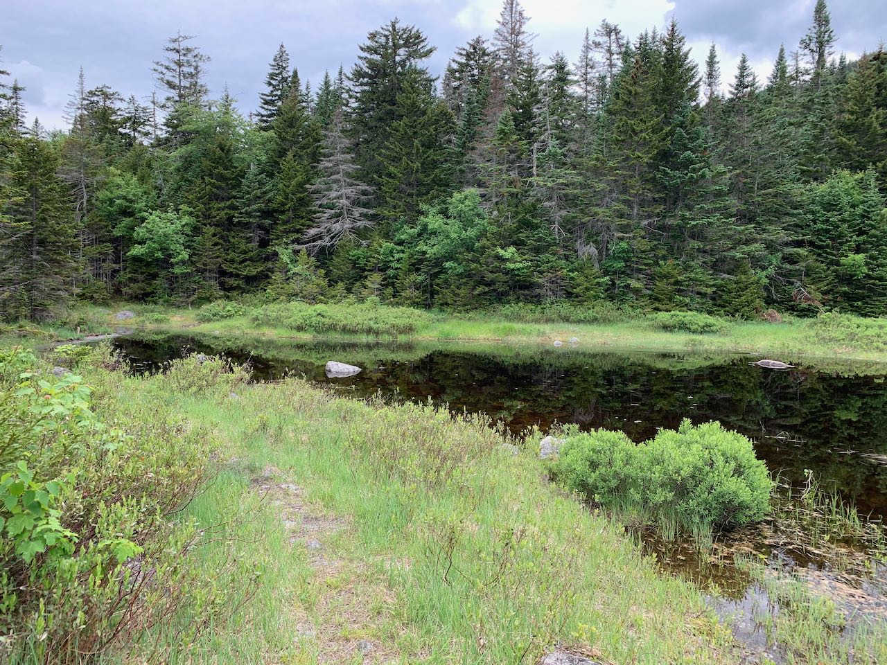
Just as you begin to ascend once again, Gordon Pond Trail departs to the right at a trail junction. It is worthwhile to follow this trail for 0.3 miles to see the pond and get a nice view up to the summit of Mt. Wolf. This trail descends gently toward the pond, then swings right away from the shore and crosses the tiny headwaters of Gordon Pond Brook. On the other side of the brook, the main trail turns right. You should take a left onto an unmarked spur trail (pay attention to this turn on the way back), which leads a short distance up to an area with several tentsites on the shore of the pond. Here, just under 1000' below the summit, you have a lovely view over the water to the top of Mt. Wolf. The reflection of the mountainside in the serene waters can be picturesque. Spend some time here exploring the scenery around the peaceful shore.
Back at the trail junction on Kinsman Ridge Trail, continue north on a steep rocky up-grade, clambering back up to the ridge crest. The trail soon lessens its attack as you climb, bending across the hillside to the right, and levels out after 0.3 miles. Another long reprieve from climbing follows, as the trail wanders across a swampy plateau for the next 0.3 miles with one rock scramble in the middle. The trail then climbs sharply over a hump and drops back down in 0.1 miles. Now, having made it this far on your long and arduous trek with many alternating ascents and descents, the final approach to the summit of Mt. Wolf begins. The trail takes a sharp right, then swings back to the left and climbs 350 feet in a quarter mile over roots and rocks. Halfway up this section, an uplifted ledge on the right provides elevation over the trees to be able to take in a limited view to the southeast. A bit further up, Gordon Pond can be glimpsed through the trees. At the top of this pitch, the trail runs along a rock face and passes a junction with an unmarked herd path that leads a short distance left to the official summit of Mt. Wolf, where a register jar is tied to a tree and there is a very slight view to the west. Your journey continues just a bit further as the main trail drops into a low point between the two summit knobs of Mt. Wolf, then reaches a junction with a spur path in 0.2 miles. Bear right onto the spur path and hop up to the eastern summit knob, where a small open ledge provides a view just barely over the treetops of the Franconia Range. This once grand view earned Mt. Wolf a place on the 52-With-a-View list before tree growth blocked out most of the view and led to Mt. Wolf's removal from the list.
Printable directions page